WEATHER — MEXICO — PUBLIC SAFETY
Hurricane Simon Forecast to Reach Category 4 Before Approaching Mexico
Simon strengthened to 90 mph early Friday. A hurricane warning covers part of Mexico's Pacific coast, where destructive winds, dangerous surf and extreme rainfall are possible this weekend.
By Health Politics Daily News Desk · Published Friday, October 9, 2026 at 6:01 a.m. America/New_York · Approximately 7 minutes

Watch in this article
Pumpjack operating at the Kern River Oil Field
A short CC0 field video provides visual context for reporting on oil production and fuel supply.
Thomas Farley / Wikimedia Commons · CC0 1.0 · License and source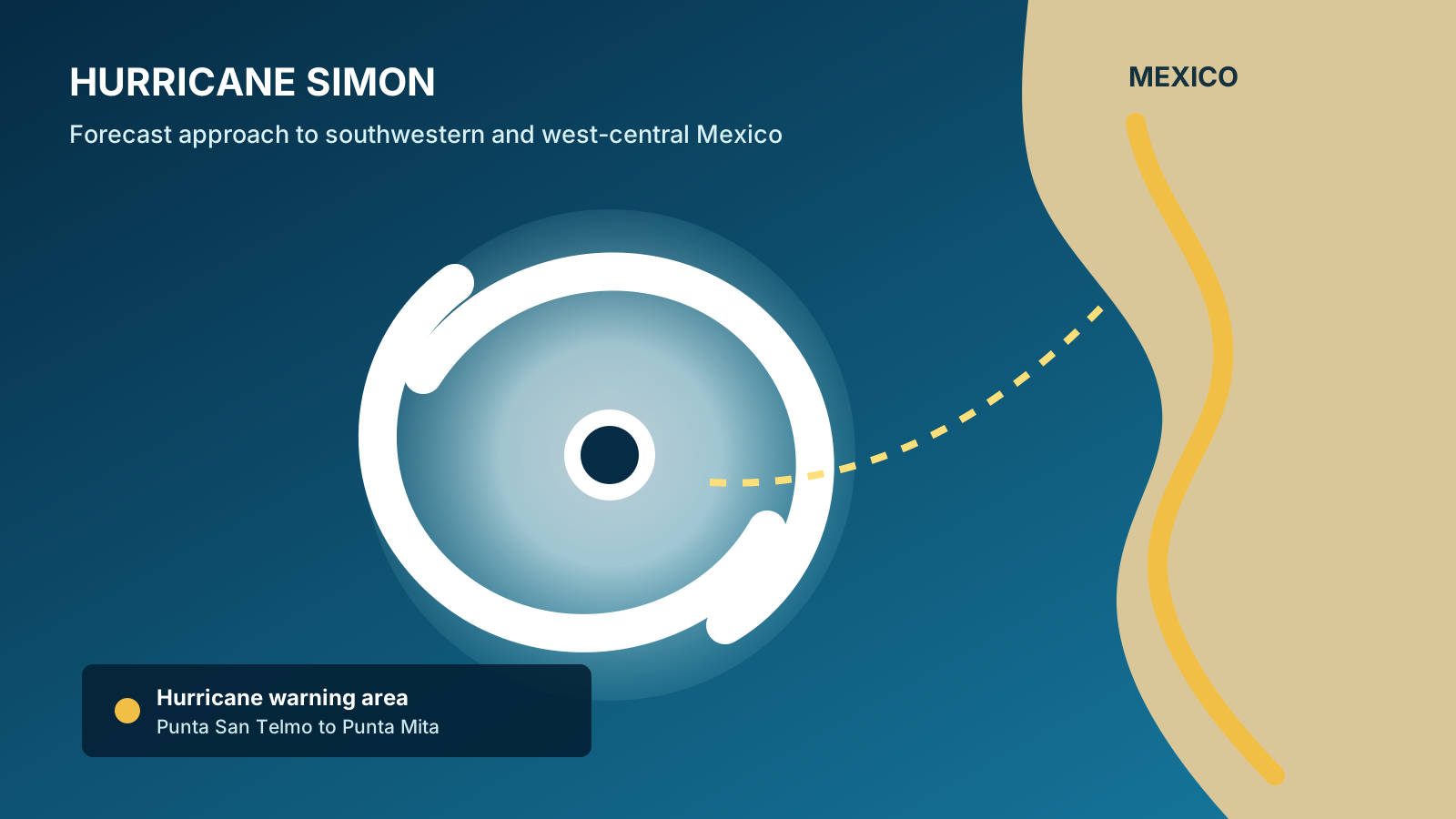
Verified Baseline
Simon is rapidly intensifying south of Manzanillo
At 3 a.m. Central Standard Time Friday, the U.S. National Hurricane Center located Simon about 220 miles south of Manzanillo with maximum sustained winds of 90 mph. The storm was moving northwest at 5 mph.
A hurricane warning was in effect from Punta San Telmo to Punta Mita. A tropical-storm watch covered the coast east of Punta San Telmo to Lázaro Cárdenas. The NHC said Simon's core was expected to approach southwestern and west-central Mexico on Saturday, with tropical-storm conditions possible before hurricane conditions arrive.
What is forecast, not yet observed: Simon is expected to continue rapidly intensifying and become a dangerous Category 4 hurricane by Saturday. Forecast intensity, the exact track and the eventual landfall point can still change.
Why It Matters
The heaviest damage may extend far beyond the eye
The NHC forecasts 8 to 15 inches of rain over parts of southwestern Mexico through Sunday, with isolated totals up to 25 inches in Michoacán, Colima, Jalisco and Nayarit. On steep terrain, that amount can trigger life-threatening flash flooding and mudslides well inland from the coast.
A dangerous storm surge is possible near and east of where the center reaches land, accompanied by large, destructive waves. Swells can also create hazardous surf and rip currents before the storm's closest approach.
Analysis: Simon combines three compounding risks: rapid strengthening that shortens preparation time, a slow approach that can prolong rainfall, and mountainous terrain that converts heavy rain into localized flooding and slope failures. Wind category alone does not capture those hazards.
Practical Implications
What residents and travelers should check
- Follow local orders: municipal and state civil-protection instructions determine evacuations and shelter access. A warning means outside preparation can become difficult or dangerous before the center arrives.
- Check official updates: the NHC is issuing frequent advisories, while Mexico's Servicio Meteorológico Nacional and civil-protection agencies provide local information.
- Avoid floodwater and unstable slopes: rain impacts can occur far from the forecast center line and after peak winds pass.
- Travel plans may change: verify flights, highways and lodging directly with operators and authorities, especially in coastal Jalisco, Colima, Michoacán and Nayarit.
- Use the forecast cone correctly: it describes the probable path of the center, not the full area where wind, rain, surge or surf may occur.
What Remains Uncertain
Small track changes could shift the worst conditions
The precise landfall location and timing remain uncertain, and later advisories could expand or move watches and warnings. Rapid-intensification forecasts are also difficult: Simon could strengthen faster or less than projected, and interaction with land can alter the wind field.
Forecast: on the NHC's current track, conditions should deteriorate along parts of the warned coast beginning Saturday, with the core approaching later Saturday and hurricane conditions possible Saturday evening or Sunday.
Opinion: Health Politics Daily does not rate storms by spectacle. The most useful measure is whether official warnings, rainfall and local evacuation information reach people early enough to reduce harm.
Bias Lens: how coverage frames the storm
The NHC measured Simon at 90 mph at 3 a.m. CST Friday, issued a hurricane warning from Punta San Telmo to Punta Mita and forecast rapid intensification before the storm approaches Mexico this weekend.
Center wire coverage: Reuters leads with the rapid strengthening and Category 4 forecast, while the Associated Press emphasizes the warning area, wind category and expected rain.
No meaningful left-versus-right split was evident in substantial original coverage available at publication. Weather reporting here is primarily operational rather than ideological; forcing partisan labels onto similar forecast summaries would create false symmetry. Readers should compare each report against the time-stamped NHC advisory because the storm is changing quickly.
Principal Sources
Official advisory and corroborating reporting
- National Hurricane Center — Advisory 8, 3 a.m. CST October 9
- Reuters — rapid intensification and forecast approach
- Associated Press — warning area and rainfall risk
No suitable directly relevant official or publisher-authorized video with clearly confirmed embedding permission was available.