WEATHER — PUBLIC SAFETY — GULF COAST
Tropical Storm Isaias Forecast to Hit Gulf Coast as Hurricane
Hurricane and storm-surge watches cover much of the northern Gulf Coast as Isaias strengthens; the exact landfall point, peak intensity and local impacts remain uncertain.
By Health Politics Daily News Desk · Published Wednesday, October 7, 2026 at 5:59 p.m. America/New_York · Approximately 8 minutes

Watch in this article
Pumpjack operating at the Kern River Oil Field
A short CC0 field video provides visual context for reporting on oil production and fuel supply.
Thomas Farley / Wikimedia Commons · CC0 1.0 · License and source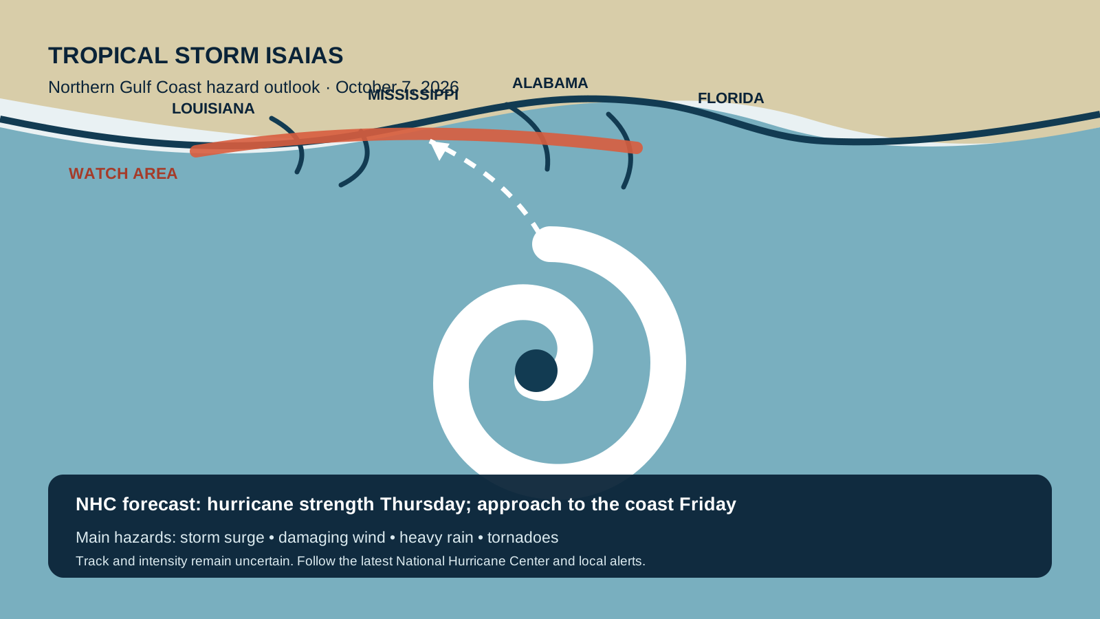
Verified Baseline
Isaias is strengthening in the Gulf, with hurricane conditions possible Friday
At 1 p.m. CDT Wednesday, the National Hurricane Center’s Advisory 4A placed Tropical Storm Isaias in the central Gulf of Mexico with maximum sustained winds of 50 mph. The storm was moving east-northeast at 8 mph. Forecasters said Isaias was expected to become a hurricane Thursday and approach the northern Gulf Coast Friday.
A hurricane watch extended from Bay St. Louis, Mississippi, to Indian Pass, Florida, according to the Associated Press. A watch means hurricane conditions are possible, generally within 48 hours; it is not confirmation that every location in the watch area will experience hurricane-force winds.
What the Forecast Shows
Storm surge, wind and heavy rain could affect a broad stretch of coast
NHC forecast water levels of 5 to 7 feet above normally dry ground in the most exposed coastal areas from Ocean Springs, Mississippi, to Indian Pass, Florida, including Mobile Bay, if peak surge coincides with high tide. Other watched sections from southeast Louisiana to Florida’s Big Bend had lower—but still dangerous—forecast ranges. Actual surge can vary sharply over short distances because of the storm’s track, coastline shape, wind direction and tide.
Tropical-storm conditions could begin around midday Friday, with hurricane conditions possible later that day. NHC forecast 3 to 6 inches of rain along the central Gulf Coast, with local totals up to 10 inches; inland areas could also see heavy rain. Flash flooding, urban flooding, isolated river flooding and tornadoes are possible.
Why It Matters
The broad hazard zone matters more than a single forecast line
A forecast track identifies the expected center, not the limits of danger. Surge can extend well away from the center, rain can fall far inland and tornadoes can develop in outer bands. The practical risk therefore reaches beyond the eventual landfall county.
Analysis: With about two days before possible coastal arrival, the combination of watches and a strengthening forecast creates a short window for households, hospitals, ports and utilities to complete preparations. Forecast: Isaias could reach major-hurricane strength over warm Gulf water, but wind shear may weaken it before landfall, so neither peak intensity nor landfall intensity is settled. Opinion: this report takes no position on evacuation policy; official local orders should control because local officials have access to zone-specific surge and infrastructure information.
Practical Implications
What residents, travelers and businesses should check now
- Know the zone, not just the city: check county or parish emergency-management maps and follow evacuation orders for the specific address. Florida’s Division of Emergency Management links to county alerts, zones, shelter information and outage resources.
- Use official updates: confirm the newest track and watches on the NHC advisory archive and local National Weather Service or emergency-management channels. Forecasts can change between news updates.
- Plan around early impacts: roads, bridges, flights, ports and fuel supply can be disrupted before the center arrives. Avoid driving through floodwater and leave time to act if local officials change a watch to a warning or issue an evacuation order.
- Document and protect: charge essential devices, safeguard medicines and documents, and review employer, school, care and travel plans. Businesses should check continuity plans and port or utility notices rather than relying on a single statewide alert.
What Remains Uncertain
The landfall point and intensity can still shift
Verified fact: Isaias was a 50 mph tropical storm at the 1 p.m. CDT advisory, with watches in effect and a hurricane forecast before coastal approach. Uncertain: the exact path, timing, strongest winds at landfall and the location of the highest surge and rain totals. A small track change could materially alter impacts for Mississippi, Alabama or Florida. New reconnaissance data may also change intensity estimates.
Forecast cones describe probable center locations and do not measure storm size or total risk. Readers should treat the advisory time on this article as a fixed snapshot and consult the latest official update before acting.
Bias Lens: how coverage is framing the storm
NHC’s 1 p.m. CDT advisory reported a 50 mph tropical storm, forecast hurricane strengthening and watches along the northern Gulf Coast. The landfall point and intensity were not yet certain.
Left-leaning coverage: The Guardian places Isaias in a wider context of an unusually late first Atlantic hurricane and extreme-weather trends. Center coverage: Reuters emphasizes the expected landfall window, wind-shear uncertainty and energy infrastructure; the Associated Press foregrounds the watches, emergency declarations and household implications. Right-leaning coverage: Fox Weather leads with rapid strengthening and Hurricane Hunter observations.
These outlets are not disputing the official baseline. Their differences are mainly editorial emphasis—climate and historical context, operational and economic effects, or storm mechanics and immediacy. Political labels describe broad editorial orientation, not the accuracy of any individual forecast report.
Principal Sources
Official advisories and corroborating reporting
- National Hurricane Center — Intermediate Advisory 4A, October 7
- National Hurricane Center — complete Isaias advisory archive
- Florida Division of Emergency Management — official alerts and resources
- Associated Press — watches, declarations and forecast context
- Reuters — track, intensity and energy-sector context
No video is embedded. No directly relevant official video with clearly confirmed embedding permission was available when this article was published.