WEATHER — MEXICO — PUBLIC SAFETY
Hurricane Polo Brings Dangerous Surf and Rain to Mexico: What to Know
Polo’s center is forecast to remain offshore, but its outer rainbands and swells are producing dangerous conditions along Mexico’s Pacific coast.
By Health Politics Daily News Desk · Published Thursday, September 24, 2026 at 2:01 p.m. America/New_York · Approximately 6 minutes

Watch in this article
Pumpjack operating at the Kern River Oil Field
A short CC0 field video provides visual context for reporting on oil production and fuel supply.
Thomas Farley / Wikimedia Commons · CC0 1.0 · License and source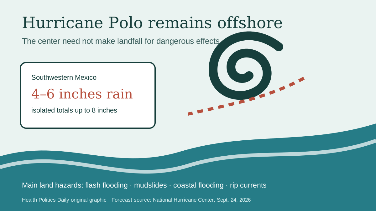
Verified Baseline
Polo is a Category 5 hurricane, and its effects are reaching land
The U.S. National Hurricane Center said Thursday that Hurricane Polo had sustained winds near 160 mph while moving northwest offshore. Its outer rainbands were spreading across southwestern Mexico, with tropical-storm-force winds likely occurring along parts of the coast, according to Reuters’ September 24 update.
The center is expected to remain offshore Thursday and then move farther to sea. That forecast reduces the likelihood of the eyewall crossing the mainland; it does not remove the rain, wave and rip-current hazards.
Where the Risk Is
Guerrero faces the highest immediate rainfall threat
The NHC forecast 4 to 6 inches of rain across coastal Guerrero through Thursday, with isolated totals up to 8 inches. Heavy rain is also expected in parts of Michoacán, Colima and Jalisco. Mexico’s Conagua has warned about landslides, rising rivers, overflow and flooding in low-lying areas.
Swells can cause life-threatening surf, rip currents and coastal flooding. Beach conditions may remain dangerous even when skies appear calmer or the storm’s center is hundreds of miles away.
Practical Implications
Residents and travelers need location-specific official information
People in affected coastal states should follow Mexico’s Servicio Meteorológico Nacional, Conagua and local Protección Civil notices; avoid beaches, river channels and flooded roads; and verify port, school and transportation changes with the responsible authority. Travelers should check directly with airlines and lodging providers before departure.
A Category 5 label describes maximum sustained wind near the hurricane’s core. It does not mean every place under rain or surf warnings will experience Category 5 winds.
What Remains Uncertain
Polo’s longer-range path and intensity can still change
Forecasters expect Polo to remain a major hurricane for the next few days and approach the Baja California Peninsula early next week, but exact position and strength forecasts become less certain with time. Rain totals also vary sharply with terrain and the placement of individual bands.
Analysis: the most consequential near-term question is not whether Polo’s eye crosses the mainland. It is where prolonged rain falls on saturated slopes and where swells coincide with exposed coastal communities.
Bias Lens: covering Hurricane Polo
Polo is an extremely powerful major hurricane offshore. Heavy rain and dangerous surf are affecting southwestern Mexico, while a mainland eyewall landfall is not in the immediate forecast.
El País stresses affected states and official preparations. Associated Press balances intensity with the offshore forecast and land hazards. Right-leaning weather coverage has tended to foreground rapid intensification and record strength. These frames can all be factual; readers should not equate the most dramatic wind figure with the forecast at their location.
Principal Sources
Evidence and reporting used
- NOAA National Hurricane Center — official advisories
- Mexico Conagua — coastal rain, wind and wave hazards
- Reuters — September 24 conditions and forecast
- Associated Press — storm context
No suitable directly relevant authorized video with clear embedding permission was available.